For Forty Years, This American Island Didn't Exist — At Least Not on Any Map
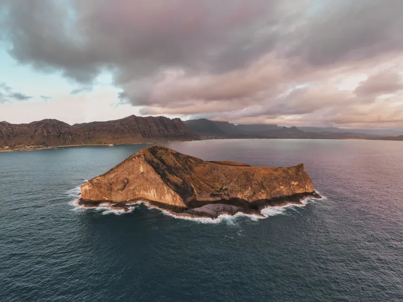
At some point in the mid-twentieth century, a cartographer made a mistake. It might have been a typo. It might have been a misread of survey data. It might have been something as mundane as a smudged notation on a working document. Whatever the cause, the effect was this: an inhabited American island vanished from official maps, and nobody caught it for forty years.
The people on the island were still there. They knew they were there. But as far as the United States government was concerned — officially, cartographically, administratively — they were nowhere.
How a Map Becomes Reality
Most of us interact with maps as though they describe the world. They don't, exactly. They define it — at least in the eyes of every institution that relies on them. The U.S. Geological Survey, the Census Bureau, the Postal Service, the Federal Emergency Management Agency, state transportation departments, county assessors: all of these bodies use official maps as their baseline for deciding what exists, where it is, and who lives there.
When an island doesn't appear on those maps, it doesn't get a census count. It doesn't get a mail route. It doesn't get factored into congressional apportionment. It doesn't receive federal funding calculated by population. It doesn't exist in the administrative sense that determines almost every interaction between a citizen and their government.
For the residents of the omitted island, this wasn't a philosophical problem. It was a daily practical one.
Life on the Invisible Island
The community was small — the kind of place where everyone knew everyone, where families had lived for generations, and where the relationship with the mainland was already complicated by geography. Islands carry their own insularity by nature. But there's a meaningful difference between being remote and being officially nonexistent.
Mail was the first and most persistent problem. Without an official address tied to a recognized location on a USGS map, the Postal Service had no mechanism to establish a formal delivery route. Residents resorted to a patchwork of workarounds — using mainland addresses, picking up mail from relatives across the water, relying on whoever happened to be making a boat trip. It worked, in the way that duct tape works: not well, and not forever.
The census issue was more quietly damaging. Every ten years, when the federal government counted heads to determine congressional representation and distribute federal resources, the island's residents weren't counted — because the island wasn't on the map that census takers used to plan their routes. The population existed in reality and not in the data, which meant that every calculation derived from that data — school funding, infrastructure grants, emergency response planning — proceeded as though those people weren't there.
And in emergencies, that invisibility had teeth. When disaster response agencies planned for regional events — hurricanes, flooding, severe storms — they worked from official maps. An island that didn't appear on those maps didn't appear in emergency plans. The residents were, in the most concrete sense, on their own.
The Error That Started It All
Cartographic errors are more common in historical records than most people realize. Before satellite imaging and GPS standardized geographic data, maps were compiled from survey reports, field notes, aerial photography, and prior maps — each step an opportunity for information to be lost, misread, or incorrectly transcribed.
The USGS has been revising and correcting its maps continuously since the agency was established in 1879. But revision is reactive. Errors don't get caught until someone notices them, and in the case of an omitted island, the people most likely to notice — the residents themselves — had limited leverage to demand a correction from a bureaucracy that, by definition, didn't officially acknowledge their existence.
There's a catch-22 embedded in that situation that's almost elegant in its cruelty. To petition the government for recognition, you need to be recognized enough to have your petition taken seriously. To have your petition taken seriously, you need documentation — addresses, census records, official correspondence. The very documentation that the omission had made impossible to obtain.
How It Got Fixed — Eventually
Resolution, when it came, arrived through the kind of indirect, accidental channel that characterizes so many bureaucratic corrections. A surveyor working on an unrelated project noted a discrepancy between field observations and official maps. A follow-up inquiry confirmed that the island existed and was inhabited. The error was traced back through successive map editions until the original omission was identified.
The correction was made. The island appeared on updated USGS maps. The Census Bureau added it to its geographic reference files. Mail service was established through official channels. Federal records were updated.
For the residents, it was a quiet kind of vindication — the government finally agreeing with something they had known all along.
But the forty-year gap left real consequences. Funding that should have flowed to the community hadn't. Infrastructure that should have been planned for wasn't. A generation of residents had navigated daily life with the particular exhaustion of people who have to explain, constantly, that they exist.
What a Dot on a Map Actually Means
It's easy to think of maps as neutral documents — objective records of physical reality. The story of the invisible island is a useful corrective to that assumption. Maps are institutional artifacts. They determine what governments see, what agencies plan for, and what resources flow where. When they're wrong, the consequences aren't abstract.
Somewhere in an American archive, there's a map — maybe a series of them — that shows a blank space where a community lived for forty years. The people were real. Their homes were real. Their lives were real.
The map just didn't get the memo.